home libri books Fumetti ebook dvd top ten sconti 0 Carrello


Torna Indietro

khormi hassan m.; kumar lalit - modelling interactions between vector-borne diseases and environment using gis

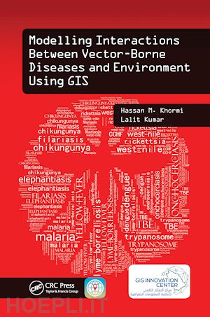
Modelling Interactions Between Vector-Borne Diseases and Environment Using GIS

;


Disponibilità: Normalmente disponibile in 20 giorni
A causa di problematiche nell'approvvigionamento legate alla Brexit sono possibili ritardi nelle consegne.


PREZZO
77,98 €
NICEPRICE
74,08 €
SCONTO
5%


Questo prodotto usufruisce delle SPEDIZIONI GRATIS
selezionando l'opzione Corriere Veloce in fase di ordine.


Pagabile anche con Carta della cultura giovani e del merito, 18App Bonus Cultura e Carta del Docente


Facebook Twitter Aggiungi commento


Spese Gratis

Dettagli

Genere:Libro
Lingua: Inglese
Editore:

CRC Press

Pubblicazione: 03/2021
Edizione: 1° edizione


Note Editore

Master GIS Applications on Modelling and Mapping the Risks of Diseases Infections transmitted by mosquitoes, ticks, triatomine bugs, sandflies, and black flies cause significant rates of death and disease, especially in developing countries. Why are certain places more susceptible to vector-borne diseases? Modelling Interactions Between Vector-Borne Diseases and Environment Using GIS reveals how using geographic information systems (GISs) can provide a greater understanding of how vector-borne diseases are spread and explores the use of geographical techniques in vector-borne disease monitoring, management, and control. This text provides readers with a better understanding of the vector-borne disease problem and its impact on public health. Introduces New Spatial Approaches Based on Location and Environment The book exposes readers to information on how to identify vector hotspots, determine when and where they can occur, and eliminate vector breeding sites. Utilizing simple illustrations based on real data, as well as the authors’ more than 20 years of experience in the field, this text combines key spatial analysis techniques available in modern GIS with real-world applications. It offers step-by-step instruction on developing vector-borne disease risk models at different spatial and temporal scales and helps practitioners formulate disease causation hypotheses and identify areas at risk. In addition, it addresses medical geography, GIS, spatial analysis, and modelling, and covers other factors related to the spread of vector-borne diseases. This book: Gives an overview of common vector-borne diseases, GIS-based mapping and modelling, impacts of climate change on vector distributions, and availability and importance of accurate epidemiologically relevant spatial data Describes modelling and simulating the prevalence of vector-borne diseases around the world Summarizes some key spatial techniques and how they can be used to aid in the analysis of geographical and attributed data Defines the concept of establishing and characterizing spatial data systems, including their quality, errors, references, and issues of scale, and building such a system from often quite separate, disparate sources Shows how to develop weather-based predictive modelling, which can be used to predict the weekly trend of vector abundance Providesa GIS case study for modelling the future potential distribution of vector-borne disease based on different climatic change scenarios Modelling Interactions Between Vector-Borne Diseases and Environment Using GIS combines spatial analysis techniques available in modern GIS, together with real-world applications to provide you with a better understanding of ways to map, model, prevent, and control vector-borne diseases.


Sommario

IntroductionVector-Borne DiseasesMapping and Modelling Based on Geographic Information SystemsImpacts of Climate Change on Vector DistributionsAvailability and Importance of Accurate Epidemiologically Relevant Spatial DataStructure of This BookReferencesModelling and Simulating the Prevalence of Vector-Borne Diseases Around the World and Efforts for Combat and ControlIntroductionGISs in Vector-Borne Disease ModellingDecision Support SystemsSpatial Analysis Capabilities of GISsExamples of GIS-Based Modelling of Vector-Borne DiseasesConclusionReferencesCartographies and Maps of Vector-Borne DiseasesIntroductionCartographies of Vector-Borne DiseasesMapping Vector-Borne DiseasesConclusionReferencesSpatial DataIntroductionThe Importance of Spatial DataCharacteristics of Spatial Data, Including Topology and Topological Relationships and Their ImportanceRelationship between EntitiesTopologyGeoreferencingSpatial ReferencingAggregating Geographic DataData TypesSpatial Data AcquisitionData Quality IssuesSources of Error in GISsIssues of ScaleMeasurement Scales: Nominal, Ordinal, Interval, and RatioSatellite Imagery as a Source of Spatial DataConclusionReferencesCommon Spatial Methods for Modelling and Analyzing Spatial and Temporal Patterns and Distributions of Mosquito-Borne DiseasesIntroductionPattern AnalysisDistribution AnalysisConclusionReferencesSpatial Variation RiskIntroductionDensity AnalysisInterpolationReferencesModelling Associations between Mosquito-Borne Diseases and Environmental and Socioeconomic FactorsIntroductionVerifying Required DataModelling Spatial AssociationsReferencesGlobal Climate Change and Modelling the Potential Distribution of Vector-Borne DiseaseIntroductionDistribution of Dengue Disease and Its VectorCLIMEX, Climatic Models, and DataThe Current and Potential Future DistributionDiscussing the Potential Future DistributionConclusionReferencesConclusionReferences


Autore

Dr. Hassan M. Khormi is an assistant professor in the Department of Geography, Umm Al-Qura University (UQU), where he teaches geographic information systems (GISs) and remote sensing. Also, Dr. Hassan is a Vice Dean of the Institute of Consulting Research and Studies. In early 2013, he accepted his position as assistant professor in the Department of Geography and as deputy director of the GIS Technology Innovation Centre for administrative affairs. He is also a consultant (part-time) at Jeddah Municipality and an adjunct lecturer in the School of Environment and Rural Science, University of New England, Australia. His main research interests are in the fields of environmental modelling and GIS applications on vector-borne diseases. Dr. Lalit Kumar is an associate professor of spatial information technologies at the University of New England in Australia. He comes from Fiji, where he undertook his undergraduate and postgraduate studies in environmental science. Dr Kumar’s expertise is in the use of GISs and remote-sensing technologies for mapping and modelling the environment, particularly natural resources and agricultural systems. In addition, he has contributed to over 150 publications, with over 100 journal articles in international peer-reviewed journals. Dr. Kumar is also an associate editor for the journal ISPRS Journal of Photogrammetry and Remote Sensing and an academic editor for PLoS ONE.


Altre Informazioni

ISBN:

9781138597235

Condizione: Nuovo
Dimensioni: 9.25 x 6.25 in Ø 1.06 lb
Formato: Brossura
Illustration Notes:65 b/w images and 6 tables
Pagine Arabe: 262


Dicono di noi