home libri books Fumetti ebook dvd top ten sconti 0 Carrello


Torna Indietro

diggle peter j. ; giorgi emanuele - model-based geostatistics for global public health

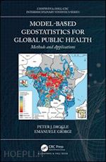
Model-based Geostatistics for Global Public Health Methods and Applications

;


Disponibilità: Normalmente disponibile in 20 giorni
A causa di problematiche nell'approvvigionamento legate alla Brexit sono possibili ritardi nelle consegne.


PREZZO
110,98 €
NICEPRICE
105,43 €
SCONTO
5%


Questo prodotto usufruisce delle SPEDIZIONI GRATIS
selezionando l'opzione Corriere Veloce in fase di ordine.


Pagabile anche con Carta della cultura giovani e del merito, 18App Bonus Cultura e Carta del Docente


Facebook Twitter Aggiungi commento


Spese Gratis

Dettagli

Genere:Libro
Lingua: Inglese
Pubblicazione: 03/2019
Edizione: 1° edizione


Note Editore

Model-based Geostatistics for Global Public Health: Methods and Applications provides an introductory account of model-based geostatistics, its implementation in open-source software and its application in public health research. In the public health problems that are the focus of this book, the authors describe and explain the pattern of spatial variation in a health outcome or exposure measurement of interest. Model-based geostatistics uses explicit probability models and established principles of statistical inference to address questions of this kind. Features: Presents state-of-the-art methods in model-based geostatistics. Discusses the application these methods some of the most challenging global public health problems including disease mapping, exposure mapping and environmental epidemiology. Describes exploratory methods for analysing geostatistical data, including: diagnostic checking of residuals standard linear and generalized linear models; variogram analysis; Gaussian process models and geostatistical design issues. Includes a range of more complex geostatistical problems where research is ongoing. All of the results in the book are reproducible using publicly available R code and data-sets, as well as a dedicated R package. This book has been written to be accessible not only to statisticians but also to students and researchers in the public health sciences. The Authors Peter Diggle is Distinguished University Professor of Statistics in the Faculty of Health and Medicine, Lancaster University. He also holds honorary positions at the Johns Hopkins University School of Public Health, Columbia University International Research Institute for Climate and Society, and Yale University School of Public Health. His research involves the development of statistical methods for analyzing spatial and longitudinal data and their applications in the biomedical and health sciences. Dr Emanuele Giorgi is a Lecturer in Biostatistics and member of the CHICAS research group at Lancaster University, where he formerly obtained a PhD in Statistics and Epidemiology in 2015. His research interests involve the development of novel geostatistical methods for disease mapping, with a special focus on malaria and other tropical diseases. In 2018, Dr Giorgi was awarded the Royal Statistical Society Research Prize "for outstanding published contribution at the interface of statistics and epidemiology." He is also the lead developer of PrevMap, an R package where all the methodology found in this book has been implemented.


Sommario

1 Introduction Motivating example: mapping river-blindness in Africa Empirical or mechanistic models What is in this book? 2 Regression modelling for spatially referenced data Linear regression models Malnutrition in Ghana Generalized linear models Logistic Binomial regression: river-blindness in Liberia Log-linear Poisson regression: abundance of Anopheles Gambia mosquitoes in Southern Cameroon Questioning the assumption of independence Testing for residual spatial correlation: the empirical variogram 3 Theory Gaussian processes Families of spatial correlation functions The exponential family The Matter family The spherical family The theoretical variogram and the nugget variance Statistical inference Likelihood-based inference Bayesian Inference Predictive inference Approximations to Gaussian processes Low-rank approximations Gaussian Markov random held approximations via stochastic partial differential equations Contents 4 The linear geostatistical model Model formulation Inference Likelihood-based inference Maximum likelihood estimation Bayesian inference Trans-Gaussian models Model validation Scenario 1: omission of the nugget effect Scenario 2: miss-specification of the smoothness parameter Scenario 3: non-Gaussian data Spatial prediction Applications Heavy metal monitoring in Galicia Malnutrition in Ghana (continued) Spatial predictions for the target population 5 Generalized linear geostatistical models 85 Model formulation Binomial sampling Poisson sampling Negative binomial sampling? Inference Likelihood-based inference Laplace approximation Monte Carlo maximum likelihood Bayesian inference Model validation Spatial prediction Applications River-blindness in Liberia (continued) Abundance of Anopheles Gambia mosquitoes in Southern Cameroon (continued) A link between geostatistical models and point processes A link between geostatistical models and spatially discrete processes 6 Geostatistical design Introduction Definitions Non-adaptive designs Two extremes: completely random and completely regular designs Inhibitory designs Contents Inhibitory-plus-close-pairs designs Comparing designs: a simple example Modified regular lattice designs Application: rolling malaria indicator survey sampling in the Manjeet perimeter, southern Malawi Adaptive designs An adaptive design algorithm Application: sampling for malaria prevalence in the Manjeet perimeter (continued) Discussion 7 Preferential sampling Definitions Preferential sampling methodology Non-uniform designs need not be preferential Adaptive designs need not be strongly preferential The Diggle, Menezes and Su model The Patti, Reich and Dunson model Monte Carlo maximum likelihood using stochastic partial differential equations Lead pollution in Galicia Mapping ozone concentration in Eastern United States Discussion 8 Zero-inaction Models with zero-inaction Inference Spatial prediction Applications River blindness mapping in Sudan and South Sudan Loa loa: mapping prevalence and intensity of infection 9 Spatio-temporal geostatistical analysis Setting the context Is the sampling design preferential? Geostatistical methods for spatio-temporal analysis Exploratory analysis: the spatio-temporal variogram Diagnostics and novel extensions Example: a model for disease prevalence with temporally varying variance Defining targets for prediction Accounting for parameter uncertainty using classical methods of inference Visualization Contents Historical mapping of malaria prevalence in Senegal from 1905 to 2014 Discussion 10 Further topics in model-based geostatistics Combining data from multiple surveys Using school and community surveys to estimate malaria prevalence in Nyanza province, Kenya Combining multiple instruments Case I: Predicting prevalence for a gold-standard diagnostic Case II: Joint prediction of prevalence from two complementary diagnostics Incomplete data Positional error Missing locations Modelling of the sampling design Appendices A Background statistical theory Probability distributions The Binomial distribution The Poisson distribution The Normal distribution Independent and dependent random variables Statistical models: responses, covariates, parameters and random effects Statistical inference The likelihood and log-likelihood functions Estimation, testing and prediction Classical inference Bayesian inference Prediction Monte Carlo methods Direct simulation Markov chain Monte Carlo Monte Carlo maximum likelihood B Spatial data handling 225 Handling shape-_les in R Handling raster-_les in R Creating spatial covariates Maps and animations References


Autore

Peter Diggle is Distinguished University Professor of Statistics in the Faculty of Health and Medicine, Lancaster University. He also holds honorary positions at the Johns Hopkins University School of Public Health, Columbia University International Research Institute for Climate and Society, and Yale University School of Public Health. His research involves the development of statistical methods for analyzing spatial and longitudinal data and their applications in the biomedical and health sciences. Dr Emanuele Giorgi is a Lecturer in Biostatistics and member of the CHICAS research group at Lancaster University, where he formerly obtained a PhD in Statistics and Epidemiology in 2015. His research interests involve the development of novel geostatistical methods for disease mapping, with a special focus on malaria and other tropical diseases. In 2018, Dr Giorgi was awarded the Royal Statistical Society Research Prize "for outstanding published contribution at the interface of statistics and epidemiology." He is also the lead developer of PrevMap, an R package where all the methodology found in this book has been implemented.


Altre Informazioni

ISBN:

9781138732353

Condizione: Nuovo
Collana: Chapman & Hall/CRC Interdisciplinary Statistics
Dimensioni: 9.25 x 6.25 in Ø 1.34 lb
Formato: Copertina rigida
Pagine Arabe: 274


Dicono di noi