home libri books Fumetti ebook dvd top ten sconti 0 Carrello


Torna Indietro
ARGOMENTO:  BOOKS > AGRARIA

sharma j.b. (curatore) - applications of small unmanned aircraft systems

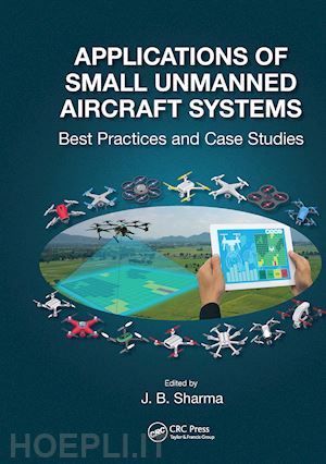
Applications of Small Unmanned Aircraft Systems Best Practices and Case Studies


Disponibilità: Normalmente disponibile in 20 giorni
A causa di problematiche nell'approvvigionamento legate alla Brexit sono possibili ritardi nelle consegne.


PREZZO
55,98 €
NICEPRICE
53,18 €
SCONTO
5%


Questo prodotto usufruisce delle SPEDIZIONI GRATIS
selezionando l'opzione Corriere Veloce in fase di ordine.


Pagabile anche con Carta della cultura giovani e del merito, 18App Bonus Cultura e Carta del Docente


Facebook Twitter Aggiungi commento


Spese Gratis

Dettagli

Genere:Libro
Lingua: Inglese
Editore:

CRC Press

Pubblicazione: 01/2023
Edizione: 1° edizione


Note Editore

Advances in high spatial resolution mapping capabilities and the new rules established by the Federal Aviation Administration in the United States for the operation of Small Unmanned Aircraft Systems (sUAS) have provided new opportunities to acquire aerial data at a lower cost and more safely versus other methods. A similar opening of the skies for sUAS applications is being allowed in countries across the world.Also, sUAS can access hazardous or inaccessible areas during disaster events and provide rapid response when needed. Applications of Small Unmanned Aircraft systems: Best Practices and Case Studies is the first book that brings together the best practices of sUAS applied to a broad range of issues in high spatial resolution mapping projects. Very few sUAS pilots have the knowledge of how the collected imagery is processed into value added mapping products that have commercial and/or academic import. Since the field of sUAS applications is just a few years old, this book covers the need for a compendium of case studies to guide the planning, data collection, and most importantly data processing and map error issues, with the range of sensors available to the user community.Written by experienced academics and professionals, this book serves as a guide on how to formulate sUAS based projects, from choice of a sUAS, flight planning for a particular application, sensors and data acquisition, data processing software, mapping software and use of the high spatial resolution maps produced for particular types of geospatial modeling. Features:Focus on sUAS based data acquisition and processing into map productsBroad range of case studies by highly experienced academicsPractical guidance on sUAS hardware, sensors, and software utilizedCompilation of workflow insights from expert professors and professionalsRelevant to academia, government, and industryPositional and thematic map accuracy, UAS curriculum development and workflow replicability issuesThis book would be an excellent text for upper-level undergraduate to graduate level sUAS mapping application courses. It is also invaluable as a reference for educators designing sUAS based curriculum as well as for potential sUAS users to assess the scope of mapping projects that can be done with this technology.


Sommario

1. sUAS Data Accuracy in Photogrammetric Workflows. 2. Unmanned Aerial Systems (UAS) and Thematic Map Accuracy Assessment. 3. Multiuser Concepts and Workflow Replicability in sUAS Applications. 4. The sUAS Educational Frontier: Mapping an Educational Pathway for the Future Workforce. 5. Federal Government Applications of UAS Technology. 6. sUAS for Wildlife Conservation - Assessing Habitat Quality of theEndangered Black-Footed Ferret. 7. Multi-View, Deep Learning, and Contextual analysis: Promising Approaches for sUAS Land Cover Classification. 8. UAS for Nature Conservation - Monitoring Invasive Species. 9. Small Unmanned Aerial Systems (sUAS) and Structure from Motion for Identifying, Documenting, and Monitoring Cultural and Natural Resources. 10. New Insights Offered by UAS for River Monitoring. 11. The Campus as a High Spatial Resolution Mapping Laboratory - Small Unmanned Aerial Systems (sUAS) Data Acquisition Analytics, and Educational Issues. 12. Flying UAVs in Constrained Environments: Best Practices for Flying within Complex Forest Canopies.


Autore

Dr. J.B. Sharma is a Professor and Assistant Department Head of Physics at the University of North Georgia. He holds the ‘Eminent Scholar of Teaching and Learning’ endowed chair since 2009 and has been a faculty member in the University System of Georgia for the past 34 years. He has a B.S in Physics from Jacksonville state University and a M.S. in Physics from the University of Georgia. He has a PhD in Geography from the University of Georgia with a specialization in Remote Sensing and Geographic Information Science. His is very interested in physics and remote sensing literacy issues in education and novel curricular development that promotes these disciplines. He was the CASE/Carnegie Georgia Professor of the Year in 1999. He received the American Society for Photogrammetry and Remote Sensing (ASPRS) 2015 Leidos-Estes Memorial teaching excellence award and was elected as a Fellow of the American Association of Physics Teachers in 2018. He serves on the Board of Directors of AmericaView which is a national consortium promoting remote sensing education, research and outreach. His research interest are physics and remote sensing education, small Unmanned Aerial Systems (sUAS) applications and Geographic Object Based Image Analysis (GEOBIA).


Altre Informazioni

ISBN:

9781032475158

Condizione: Nuovo
Dimensioni: 10 x 7 in Ø 2.29 lb
Formato: Brossura
Illustration Notes:68 b/w images and 29 color images
Pagine Arabe: 308


Dicono di noi