home libri books Fumetti ebook dvd top ten sconti 0 Carrello


Torna Indietro

wiseman james r. (curatore); el-baz farouk (curatore) - remote sensing in archaeology

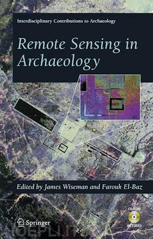
Remote Sensing in Archaeology

;


Disponibilità: Normalmente disponibile in 15 giorni
A causa di problematiche nell'approvvigionamento legate alla Brexit sono possibili ritardi nelle consegne.


PREZZO
216,98 €
NICEPRICE
206,13 €
SCONTO
5%


Questo prodotto usufruisce delle SPEDIZIONI GRATIS
selezionando l'opzione Corriere Veloce in fase di ordine.


Pagabile anche con Carta della cultura giovani e del merito, 18App Bonus Cultura e Carta del Docente


Facebook Twitter Aggiungi commento


Spese Gratis

Dettagli

Genere:Libro
Lingua: Inglese
Editore:

Springer US

Pubblicazione: 04/2007
Edizione: 2007


Trama

Over the last few decades, a revolution took place in our ability to observe and “explore” our home planet using spaceborne and airborne remote sensing instruments. This revolution resulted from the new capability of observing on a large, regional and global, scale surface patterns and features, and from using multispectral instruments to observe surface signatures not visible to the human eye, and to penetrate below the surface cover using microwave radiation. Over the last decade, this new technology is being brought to bear in the field of archaeology. As nicely and comprehensively described in this book, remote sensing techniques are bringing new powerful tools to help archaeologists in their quest of discovery and exploration. Even though this field is still in its infancy, the different articles in this book give us a glimpse of the things to come and the great potential of remote sensing in archaeology. The editors have brought an excellent sampling of authors that illustrate how remote sensing techniques are being used in the real world of arc- ological exploration. A number of chapters illustrate how spaceborne and airborne remote sensing instruments are being used to decipher surface morphological features in arid (Egypt, Arabia), semi-arid (Greece, Ethiopia, Italy), as well as tropical regions (Costa Rica, Guatemala, Cambodia) to help in archeological and paleontological exploration. They illustrate the use of surface-cover penetration with radars, high-resolution multispectral imaging on a regional basis, as well as topographic signatures acquired with spaceborne and airborne sensors.


Sommario

Radar And Satellite Images.- Imaging Radar in Archaeological Investigations: An Image Processing Perspective.- Radar Images and Geoarchaeology of the Eastern Sahara.- Southern Arabian Desert Trade Routes, Frankincense, Myrrh, and the Ubar Legend.- The Use of Interferometric Synthetic Aperture Radar (InSAR) in Archaeological Investigations and Cultural Heritage Preservation.- Detection and Identification of Archaeological Sites and Features Using Synthetic Aperture Radar (SAR) Data Collected from Airborne Platforms.- Putting Us on the Map: Remote Sensing Investigation of the Ancient Maya Landscape.- Creating and Perpetuating Social Memory Across the Ancient Costa Rican Landscape.- Spaceborne and Airborne Radar at Angkor: Introducing New Technology to the Ancient Site.- Aerial Photography and Fractals.- Remote Sensing, Fractals, and Cultural Landscapes: An Ethnographic Prolegomenon Using U2 Imagery.- Geographic Information Systems.- Understanding Archaeological Landscapes: Steps Towards an Improved Integration of Survey Methods in the Reconstruction of Subsurface Sites in South Tuscany.- Remote Sensing and GIS Analysis of a Maya City and Its Landscape: Holmul, Guatemala.- Remote Sensing and GIS Use in the Archaeological Analysis of the Central Mesopotamian Plain.- Geophysical Prospecting and Analytical Presentations.- Ground-penetrating Radar for Archaeological Mapping.- Integrating Multiple Geophysical Datasets.- Ground Penetrating Radar Advances in Subsurface Imaging for Archaeology.- Landscape Archaeology and Remote Sensing of a Spanish-Conquest Town: Ciudad Vieja, El Salvador.- Urban Structure at Tiwanaku: Geophysical Investigations in the Andean Altiplano.- Geophysical Archaeology in the Lower Amazon: A Research Strategy.- Maritime Setting Applications.- Archaeological Oceanography.- Precision Navigation and Remotes Sensing for Underwaters Archaeology.- Cultural Resources and Heritage Management.- Applications of Remote Sensing to the Understanding and Management of Cultural Heritage Sites.


Altre Informazioni

ISBN:

9780387444536

Condizione: Nuovo
Collana: Interdisciplinary Contributions to Archaeology
Dimensioni: 235 x 155 mm
Formato: Copertina rigida
Illustration Notes:XV, 554 p. 129 illus. With online files/update.
Pagine Arabe: 554
Pagine Romane: xv


Dicono di noi