home libri books Fumetti ebook dvd top ten sconti 0 Carrello


Torna Indietro
ARGOMENTO:  BOOKS > AGRARIA

thenkabail prasad (curatore); lyon john g. (curatore); turral hugh (curatore); biradar chandrashekhar (curatore) - remote sensing of global croplands for food security

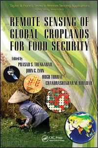
Remote Sensing of Global Croplands for Food Security

; ; ;


Disponibilità: Normalmente disponibile in 20 giorni
A causa di problematiche nell'approvvigionamento legate alla Brexit sono possibili ritardi nelle consegne.


PREZZO
84,98 €
NICEPRICE
80,73 €
SCONTO
5%


Questo prodotto usufruisce delle SPEDIZIONI GRATIS
selezionando l'opzione Corriere Veloce in fase di ordine.


Pagabile anche con Carta della cultura giovani e del merito, 18App Bonus Cultura e Carta del Docente


Facebook Twitter Aggiungi commento


Spese Gratis

Dettagli

Genere:Libro
Lingua: Inglese
Editore:

CRC Press

Pubblicazione: 11/2018
Edizione: 1° edizione


Note Editore

Increases in populations have created an increasing demand for food crops while increases in demand for biofuels have created an increase in demand for fuel crops. What has not increased is the amount of croplands and their productivity. These and many other factors such as decreasing water resources in a changing climate have created a crisis like situation in global food security. Decision makers in these situations need accurate information based on science. Remote Sensing of Global Croplands for Food Security provides a comprehensive knowledge base in use of satellite sensor-based maps and statistics that can be used to develop strategies for croplands (irrigated and rainfed) and their water use for food security. Over 50 Multi-disciplinary Global Experts Give Insight and Provide Practical Approaches Emphasizing practical mapping technologies based on advanced remote sensing data and methods, this book provides approaches for estimating irrigated and rainfed cropland areas and their water use on a national, continental, or global basis. Written by 50+ leading experts working at the forefront of this critical area, it offers case studies from a variety of continents highlighting the subtle requirements of each. In a very practical way it demonstrates the experience, utility, and models for determining water resources used and resulting yields of irrigated and rainfed croplands. The authors discuss: (a) innovative methods used for mapping croplands, (b) approaches adopted to collect cropland data in different countries by traditional and non-traditional means, (c) accuracies, uncertainties, and errors involved in producing cropland products, (d) surface energy balance models used to assess crop water use, and (e) extensive results and outcomes pertaining to global croplands and their water use. Develop Strategies for an Enhanced Green Revolution and an Accelerated Blue Revolution Linking croplands to water use and food security, the book provides a global perspective on this sensitive issue. It gives insight into the extent of cropland usage, their spatial distribution, their cropping intensities, and their water use patterns. The editors collect the experience, methods, models, and results that show the way forward and help in decision-making on water resources and food security. All of this is required for developing strategies for an enhanced green revolution and for an accelerated blue revolution.


Sommario

Background and History of Global Irrigated Area Maps (GIAM)Context, Need: The Need and Scope for Mapping Global Irrigated and Rain-Fed AreasHugh Turral, Prasad S. Thenkabail, John G. Lyon, andChandrashekhar M. BiradarA History of Irrigated Areas of the WorldY.J. Li, Prasad S. Thenkabail, Chandrashekhar M. Biradar, Praveen Noojipady, Venkateswarlu Dheeravath, Manohar Velpuri, Obi Reddy P. Gangalakunta, and Xueliang L. CaiGlobal Irrigated Area Mapping (GIAM) Using Remote SensingGlobal Irrigated Area Maps (GIAM) and Statistics Using Remote SensingPrasad S. Thenkabail, Chandrashekhar M. Biradar, Praveen Noojipady, Venkateswarlu Dheeravath, MuraliKrishna Gumma, Y.J. Li, Manohar Velpuri, and Obi Reddy P. GangalakuntaGIAM Mapping Section for Selected Global RegionsUncertainty of Estimating Irrigated Areas in ChinaSongcai You, Shunbao Liao, Suchuang Di, and Ye YuanIrrigated Areas of India Derived from Satellite Sensors and National Statistics: A Way Forward from GIAM ExperienceObi Reddy P. Gangalakunta, Venkateswarlu Dheeravath, Prasad S. Thenkabail, G. Chandrakantha, Chandrashekhar M. Biradar, Praveen Noojipady, Manohar Velpuri, and Maji Amal KumarMapping Irrigated Lands across the United States Using MODIS Satellite ImageryJesslyn F. Brown, Susan Maxwell, and Shariar PervezUse of Remote Sensing to Map Irrigated Agriculture in Areas Overlying the Ogallala Aquifer, United StatesBethany Kurz and Santhosh SeelanAssessing the Extent of Urban Irrigated Areas in the United StatesCristina Milesi, Christopher D. Elvidge, and Ramakrishna R. NemaniThe Challenges of Mapping Irrigated Areas in a Temperate Climate: Experiences from EnglandJerry W. Knox, S.A.M. Shamal, E.K. Weatherhead, and J.A. Rodriguez-DiazIrrigated Area Mapping in the CWANA Region and Its Use in Spatial Applications for Land Use Planning, Poverty Mapping, and Water Resources ManagementEddy De PauwSubpixel Mapping of Rice Paddy Fields over Asia Using MODIS Time SeriesWataru Takeuchi and Yoshifumi YasuokaEvapotranspiration Models, Water Use, and Irrigated AreasAssessment of Water Resources and Demands of Agriculture in the Semiarid Middle EastRoland A. Geerken, Ronald B. Smith, Z. Masri, and Eddy De PauwEstimating Actual Evapotranspiration from Irrigated Fields Using a Simplified Surface Energy Balance ApproachGabriel B. Senay, Michael E. Budde, James P. Verdin, and James RowlandSatellite-Based Assessment of Agricultural Water Consumption, Irrigation Performance, and Water Productivity in a Large Irrigation System in PakistanMobin-ud-Din Ahmad, Hugh Turral, Aamir Nazeer, and Asghar HussainRain-Fed Cropland Areas of the WorldGlobal Map of Rainfed Cropland Areas (GMRCA) and Statistics Using Remote SensingChandrashekhar M. Biradar, Prasad S. Thenkabail, Praveen Noojipady, Y.J. Li, Venkateswarlu Dheeravath, Manohar Velpuri, Hugh Turral, Xueliang L. Cai, MuraliKrishna Gumma, Obi Reddy P. Gangalakunta, Mitchell A. Schull, Ranjith D. Alankara, Sarath Gunasinghe, and Xiangming XiaoMethods of Mapping Croplands Using Remote SensingMultiangle Spectral Measurements: A Way to Distinguish Cropping AreasFrancis CanisiusApplying Pattern Recognition to Satellite Data for Detecting Irrigated Lands: A Case Study for Georgia, United StatesVijendra K. Boken, Gerrit Hoogenboom, and Gregory L. EassonMapping Irrigated Crops from Landsat ETM + Imagery for Heterogeneous Cropping Systems in PakistanM.S.D.N. Gamage, Mobin-ud-Din Ahmad, and Hugh TurralAccuracies and ErrorsAccuracy and Error Analysis of Global and Local Maps: Lessons Learned and Future ConsiderationsRussell G. CongaltonWay Forward in Mapping Global Irrigated and Rain-Fed CroplandsRemote Sensing of Global Croplands for Food Security: Way ForwardPrasad S. Thenkabail and John G. Lyon


Autore

Dr. Prasad S. Thenkabail is a well known global expert in remote sensing and spatial sciences. Currently, works as a Research Geographer-15 with the U.S. Geological Survey (USGS). Dr. Thenkabail has conducted pioneering scientific research work in two major areas: Hyperspectral remote sensing of vegetation; Global Irrigated and Rainfed Cropland Mapping. His research papers have won three American Society of Photogrammetric Engineering and Remote Sensing (ASPRS) awards: (a) 2015 ERDAS award for best scientific paper (second author), (a) 2008 ASPRS President’s award (first author), (b) 1994 Autometric Award (first author). He is the Editor-in- Chief of seminal books (Publisher: Taylor and Francis Inc.): (a) three volume (including this), 82 Chapter, Remote Sensing Handbook (November 2015), (b) Hyperspectral Remote Sensing of Vegetation (2012), and (c) Remote Sensing of Global Croplands for Food Security (2009). He is the Editor-in-Chief of Remote Sensing Open Access Journal and is on the editorial board of Remote Sensing of Environment, and ISPRS Journal of Photogrammetry and Remote Sensing. Prasad has work experience in 25+ Countries including working in key remote sensing research\leadership positions @ the International Water Management Institute (IWMI), International Institute of Tropical Agriculture (IITA), Yale Center for Earth Observation (YCEO), and the Indian National Remote Sensing Agency. He was selected by NASA and USGS as a member of Landsat Science Team Member (2007-20011), and was a scientific advisory board member of Rapideye (2001). John G. Lyon has conducted scientific and engineering research and administrative functions throughout his career. He is formerly the senior physical scientist in the U.S. Environmental Protection Agency’s Office of Research and Development (ORD) and Office of the Science Advisor in Washington, DC, where he co-led work on the Group on Earth Observations and the USGEO subcommittee of the Committee on Environment and Natural Resources, and research on geospatial issues. Lyon was director of ORD’s Environmental Sciences Division for approximately eight years. He was educated at Reed College in Portland, Oregon, and the University of Michigan in Ann Arbor.


Altre Informazioni

ISBN:

9781138116559

Condizione: Nuovo
Collana: Remote Sensing Applications Series
Dimensioni: 9.25 x 6.25 in Ø 1.80 lb
Formato: Brossura
Illustration Notes:198 b/w images, 40 color images, 60 tables and 20
Pagine Arabe: 524
Pagine Romane: xxxii


Dicono di noi