home libri books Fumetti ebook dvd top ten sconti 0 Carrello


Torna Indietro

kent alexander - landmarks in mapping

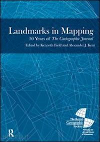
Landmarks in Mapping 50 Years of the Cartographic Journal


Disponibilità: Normalmente disponibile in 20 giorni
A causa di problematiche nell'approvvigionamento legate alla Brexit sono possibili ritardi nelle consegne.


PREZZO
167,98 €
NICEPRICE
159,58 €
SCONTO
5%


Questo prodotto usufruisce delle SPEDIZIONI GRATIS
selezionando l'opzione Corriere Veloce in fase di ordine.


Pagabile anche con Carta della cultura giovani e del merito, 18App Bonus Cultura e Carta del Docente


Facebook Twitter Aggiungi commento


Spese Gratis

Dettagli

Genere:Libro
Lingua: Inglese
Editore:

Routledge

Pubblicazione: 06/2014
Edizione: 1° edizione


Note Editore

This book brings a flavour of the quality and breadth of the Journal into one volume that spans its history. It includes 16 classic papers from the archive, some of which will be well known to the cartographic community, while others may not be as obvious.


Sommario

1. Introduction 2. Automation in the Preparation of Thematic Maps 3. Reflections on 'Automation in the Preparation of Thematic Mapping' 4. Visual Perception and Map Design 5. Reflections on 'Visual Perception and Map Design' 6. The Map as a Communication System 7. Reflections on 'The Map as a Communication System' 8. Topographical Relief Depiction by Hachures with Computer and Plotter 9. Reflections on 'Topographic Relief Depiction by Hachures with Computer and Plotter' 10. A Knowledge Based System for Cartographic Symbol Design 11. Reflections on 'A Knowledge Based System for Cartographic Symbol Design' 12. The Role of the Ordnance Survey of Great Britain 13. Reflections on 'The Role of the Ordnance Survey of Great Britain' 14. Line Generalization by Repeated Elimination of Points 15. Reflections on 'Line Generalization by Repeated Elimination of Points' 16. Map Design for Census Mapping 17. Reflections on 'Map Design for Census Mapping' 18. ColorBrewer.org: An Online Tool for Selecting Colour Schemes for Maps 19. Reflections on ‘ColorBrewer.org: An Online Tool for Selecting Colour Schemes for Maps’ 20. Mapping the Results of Geographically Weighted Regression 21. Reflections on 'Mapping the Results of Geographically Weighted Regression' 22. Cultures of Map Use 23. Reflections on 'Cultures of Map Use' 24. Usability Evaluation of Web Mapping Sites 25. Reflections on 'Usability Evaluation of Web Mapping Sites' 26. Unfolding the Earth: Myriahedral Projections 27. Reflections on 'Unfolding the Earth: Myriahedral Projections' 28. Stylistic Diversity in European State 1:50 000 Topographic Maps 29. Reflections on 'Stylistic Diversity in European State 1:50 000 Topographic Maps' 30. Visualization of Origins, Destinations and Flows with OD Maps 31. Reflections on 'Visualization of Origins, Destinations and Flow with OD Maps' 32. Reasserting Design Relevance in Cartography: Some Concepts 33. Reasserting Design Relevance in Cartography: Some Examples 34. Reflections of 'Reasserting Design Relevance in Cartography'


Altre Informazioni

ISBN:

9781909662384

Condizione: Nuovo
Dimensioni: 9.75 x 6.75 in Ø 2.19 lb
Formato: Copertina rigida
Pagine Arabe: 416


Dicono di noi